The Blue Marble, a photograph of the planet Earth made on 7 December 1972 by the crew of the Apollo 17 spacecraft.
The world is the totality of entities, the whole of reality, or everything that exists. The nature of the world has been conceptualized differently in different fields. Some conceptions see the world as unique while others talk of a "plurality of worlds". Some treat the world as one simple object while others analyze the world as a complex made up of parts.
In scientific cosmology, the world or universe is commonly defined as "[t]he totality of all space and time; all that is, has been, and will be". Theories of modality talk of possible worlds as complete and consistent ways how things could have been. Phenomenology, starting from the horizon of co-given objects present in the periphery of every experience, defines the world as the biggest horizon or the "horizon of all horizons". In philosophy of mind, the world is contrasted with the mind as that which is represented by the mind. Theology conceptualizes the world in relation to God, for example, as God's creation, as identical to God or as the two being interdependent. In religions, there is a tendency to downgrade the material or sensory world in favor of a spiritual world to be sought through religious practice. A comprehensive representation of the world and our place in it, as is found in religions, is known as a worldview. Cosmogony is the field that studies the origin or creation of the world while eschatology refers to the science or doctrine of the last things or of the end of the world.
Globalism has multiple meanings. In political science, it is used to describe "attempts to understand all the interconnections of the modern world—and to highlight patterns that underlie (and explain) them". While primarily associated with world-systems, it can be used to describe other global trends. The concept of globalism is also classically used to focus on the ideologies of globalization (the subjective meanings) instead of its processes (the objective practices); in this sense, "globalism" is to globalization what "nationalism" is to nationality.
The largest Antarctic ozone hole recorded as of September 2006 The Montreal Protocol is an international treaty designed to protect the ozone layer by phasing out the production of numerous substances that are responsible for ozone depletion. It was agreed on 16 September 1987, and entered into force on 1 January 1989. Since then, it has undergone nine revisions, in 1990 (London), 1991 (Nairobi), 1992 (Copenhagen), 1993 (Bangkok), 1995 (Vienna), 1997 (Montreal), 1998 (Australia), 1999 (Beijing) and 2016 (Kigali) As a result of the international agreement, the ozone hole in Antarctica is slowly recovering. Climate projections indicate that the ozone layer will return to 1980 levels between 2040 (across much of the world) and 2066 (over Antarctica). Due to its widespread adoption and implementation, it has been hailed as an example of successful international co-operation. Former UN Secretary-General Kofi Annan stated that "perhaps the single most successful international agreement to date has been the Montreal Protocol". In comparison, effective burden-sharing and solution proposals mitigating regional conflicts of interest have been among the success factors for the ozone depletion challenge, where global regulation based on the Kyoto Protocol has failed to do so. In this case of the ozone depletion challenge, there was global regulation already being installed before a scientific consensus was established. Also, overall public opinion was convinced of possible imminent risks.
The Web was invented by English computer scientist Tim Berners-Lee while at CERN in 1989 and opened to the public in 1991. It was conceived as a "universal linked information system". Documents and other media content are made available to the network through web servers and can be accessed by programs such as web browsers. Servers and resources on the World Wide Web are identified and located through character strings called uniform resource locators (URLs). (Full article...)
The report "assesses the ability of countries to provide high levels of prosperity to their citizens". This in turn depends on how productively a country uses available resources. Therefore, the Global Competitiveness Index measures the set of institutions, policies, and factors that set the sustainable current and medium-term levels of economic prosperity." (Full article...)
Image 7
Artist's rendition of a fully-frozen Snowball Earth with no remaining liquid surface water.The Snowball Earth is a geohistorical hypothesis that proposes during one or more of Earth's icehouse climates, the planet's surface became entirely or nearly entirely frozen with no liquid oceanic or surface water exposed to the atmosphere. The most academically referred period of such global glaciation is believed to have occurred sometime before 650 mya during the Cryogenian period.
Proponents of the hypothesis argue that it best explains sedimentary deposits that are generally believed to be of glacial origin at tropical palaeolatitudes and other enigmatic features in the geological record. Opponents of the hypothesis contest the geological evidence for global glaciation and the geophysical feasibility of an ice- or slush-covered ocean, and they emphasize the difficulty of escaping an all-frozen condition. Several unanswered questions remain, including whether Earth was a full snowball or a "slushball" with a thin equatorial band of open (or seasonally open) water. The snowball-Earth episodes are proposed to have occurred before the sudden radiation of multicellular bioforms known as the Cambrian explosion. The most recent snowball episode may have triggered the evolution of multicellularity. (Full article...)
Image 3Tiktaalik, a fish with limb-like fins and a predecessor of tetrapods. Reconstruction from fossils about 375 million years old. (from History of Earth)
Image 6Shanghai. China urbanized rapidly in the 21st century.
Image 7Artist's conception of Hadean Eon Earth, when it was much hotter and inhospitable to all forms of life. (from History of Earth)
Image 8Earth's land use for human agriculture (from Earth)
Image 9The replicator in virtually all known life is deoxyribonucleic acid. DNA is far more complex than the original replicator and its replication systems are highly elaborate. (from History of Earth)
Image 13An animation of the changing density of productive vegetation on land (low in brown; heavy in dark green) and phytoplankton at the ocean surface (low in purple; high in yellow) (from Earth)
Image 21An artist's impression of the Archean, the eon after Earth's formation, featuring round stromatolites, which are early oxygen-producing forms of life from billions of years ago. After the Late Heavy Bombardment, Earth's crust had cooled, its water-rich barren surface is marked by continents and volcanoes, with the Moon still orbiting Earth half as far as it is today, appearing 2.8 times larger and producing strong tides. (from Earth)
Image 22A 2012 artistic impression of the early Solar System's protoplanetary disk from which Earth and other Solar System bodies were formed (from Earth)
Image 24Pangaea was a supercontinent that existed from about 300 to 180 Ma. The outlines of the modern continents and other landmasses are indicated on this map. (from History of Earth)
Image 25Chloroplasts in the cells of a moss (from History of Earth)
Image 39A view of Earth with its global ocean and cloud cover, which dominate Earth's surface and hydrosphere; at Earth's polar regions, its hydrosphere forms larger areas of ice cover. (from Earth)
Image 40Cave paintings, Lascaux, France, c. 17,000 BCE
Image 49Geologic map of North America, color-coded by age. From most recent to oldest, age is indicated by yellow, green, blue, and red. The reds and pinks indicate rock from the Archean.
Image 50Artist's impression of Earth during the later Archean, the largely cooled planetary crust and water-rich barren surface, marked by volcanoes and continents, features already roundmicrobialites. The Moon, still orbiting Earth much closer than today and still dominating Earth's sky, produced strong tides. (from History of Earth)
Image 51Artist's rendition of an oxinated fully-frozen Snowball Earth with no remaining liquid surface water. (from History of Earth)
Image 65Exaggerated illustration of Earth's elliptical orbit around the Sun, marking that the orbital extreme points (apoapsis and periapsis) are not the same as the four seasonal extreme points, the equinox and solstice (from Earth)
Image 66Trilobites first appeared during the Cambrian period and were among the most widespread and diverse groups of Paleozoic organisms. (from History of Earth)
Image 67Angkor Wat temple complex, Cambodia, early 12th century
Image 68Change in average surface air temperature and drivers for that change. Human activity has caused increased temperatures, with natural forces adding some variability. (from Earth)
Image 70A reconstruction of Pannotia (550 Ma). (from History of Earth)
Image 71Earth's western hemisphere showing topography relative to Earth's center instead of to mean sea level, as in common topographic maps (from Earth)
Image 84Japanese depiction of a Portuguese carrack. European maritime innovations led to proto-globalization.
Image 85Artist's impression of a Hadean landscape with the relatively newly formed Moon still looming closely over Earth and both bodies sustaining strong volcanism. (from History of Earth)
Image 86A map of heat flow from Earth's interior to the surface of Earth's crust, mostly along the oceanic ridges (from Earth)
Image 87Earth's night-side upper atmosphere appearing from the bottom as bands of afterglow illuminating the troposphere in orange with silhouettes of clouds, and the stratosphere in white and blue. Next the mesosphere (pink area) extends to the orange and faintly green line of the lowest airglow, at about one hundred kilometers at the edge of space and the lower edge of the thermosphere (invisible). Continuing with green and red bands of aurorae streching over several hundred kilometers. (from Earth)
The metropolitan area is named after the Rhine and Ruhr rivers, which are the region's defining geographical features and historically its economic backbone. (Full article...)
As of 2013, the Kingdom of Denmark, including the Faroe Islands and Greenland, had a total of 1,419 islands greater than 100 square metres (1,100 sq ft) in area; 443 of these have been named and 78 are inhabited. Spanning a total area of 42,943 km2 (16,580 sq mi), metropolitan Denmark consists of the northern part of the Jutlandpeninsula and an archipelago of 406 islands. Of these, the most populated island is Zealand, on which the capital and largest city, Copenhagen, is situated, followed by Funen, the North Jutlandic Island, and Amager. Denmark has flat, arable land, sandy coasts, low elevations, and a temperate climate. It had a population of 5,964,059 (1 December 2023), of whom 800,000 live in Copenhagen (2 million in the wider area). Denmark exercises hegemonic influence in the Danish Realm, devolving powers to handle internal affairs. Home rule was established in the Faroe Islands in 1948 and in Greenland in 1979; the latter obtained further autonomy in 2009. (Full article...)
The Seven Wonders of Colombia (Spanish: Siete maravillas de Colombia) was a 2007 competition sponsored by El Tiempo. The newspaper asked readers to nominate and vote for man-made structures whose engineering, architectural or historical value deserved special recognition. (Full article...)
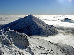
The mountain of Stob Binnein lies in the Loch Lomond and The Trossachs National Park. Many parts of Scotland are protected in accordance with a number of national and international designations because of their environmental, historical or cultural value. Protected areas can be divided according to the type of resource which each seeks to protect. NatureScot has various roles in the delivery of many environmental designations in Scotland, i.e. those aimed at protecting flora and fauna, scenic qualities and geological features. Historic Environment Scotland is responsible for designations that protect sites of historic and cultural importance. Some international designations, such as World Heritage Sites, can cover both categories of site.
The various designations overlap considerably with many protected areas being covered by multiple designations with different boundaries. (Full article...)
The headquarters of the National Parks Service are in downtown Buenos Aires, on Santa Fe Avenue. A library and information centre are open to the public. The administration also covers the national monuments, such as the Jaramillo Petrified Forest, and natural and educational reserves. (Full article...)
Image 6
Protected areas of Canada consist of approximately 12.1 percent of the nation's landmass and freshwater are considered conservation areas, including 11.4 percent designated as protected areas. Approximately 13.8 percent of Canada's territorial waters are conserved, including 8.9 percent designated as protected areas. Terrestrial areas conserved have increased by 65 percent in the 21st century, while marine areas conserved have increased by more than 3,800 percent.
Conservation and protected areas have different mandates depending on the organization which manages them, with some areas having a greater focus on ecological integrity, historical preservation, public usage, scientific research, or a combination of usages. Some areas such as the Polar Bear Pass, are co-managed and overseen by government and local indigenous agencies. (Full article...)
As of 2022, based on the latest Collaborative Australian Protected Areas Database report, it contains 1857 separate land-based protected areas with a total area of 76,142,710 hectares (188,152,700 acres), accounting for just over 30 percent of the state's land mass. By area, Indigenous Protected Areas account for the largest part of this, almost 67 percent while, by number, nature reserves hold the majority with two-third of all land-based protected areas being nature reserves. (Full article...)
Image 2A plate tectonics map with volcano locations indicated with red circles
Image 3Only a few of the largest large igneous provinces appear (coloured dark purple) on this geological map, which depicts crustal geologic provinces as seen in seismic refraction data


 Non-UN member states recognised by at least one UN member stateNon-UN member states recognised only by other non-UN member states


 Taj Mahal, Mughal Empire, India
 Last Moon landing: Apollo 17 (1972)
 Tiktaalik, a fish with limb-like fins and a predecessor of tetrapods. Reconstruction from fossils about 375 million years old. (from History of Earth)
 Fall of the Berlin Wall, 1989
 Shanghai. China urbanized rapidly in the 21st century.
 Artist's conception of Hadean Eon Earth, when it was much hotter and inhospitable to all forms of life. (from History of Earth)
 Earth's land use for human agriculture (from Earth)
 The replicator in virtually all known life is deoxyribonucleic acid. DNA is far more complex than the original replicator and its replication systems are highly elaborate. (from History of Earth)
 A Benin Bronze head from Nigeria
 Persepolis, Achaemenid Empire, 6th century BCE
 Machu Picchu, Inca Empire, Peru
 An animation of the changing density of productive vegetation on land (low in brown; heavy in dark green) and phytoplankton at the ocean surface (low in purple; high in yellow) (from Earth)
 Notre-Dame de Paris, France
 Graph showing range of estimated partial pressure of atmospheric oxygen through geologic time (from History of Earth)
 Ajloun Castle, Jordan
 View of Earth from the Moon by the Lunar Reconnaissance Orbiter (from Earth)
 An artist's rendering of a protoplanetary disk (from History of Earth)
 Cross-section through a liposome (from History of Earth)
 Artist's conception of Devonian flora (from History of Earth)
 An artist's impression of the Archean, the eon after Earth's formation, featuring round stromatolites, which are early oxygen-producing forms of life from billions of years ago. After the Late Heavy Bombardment, Earth's crust had cooled, its water-rich barren surface is marked by continents and volcanoes, with the Moon still orbiting Earth half as far as it is today, appearing 2.8 times larger and producing strong tides. (from Earth)
 A 2012 artistic impression of the early Solar System's protoplanetary disk from which Earth and other Solar System bodies were formed (from Earth)
 Pangaea was a supercontinent that existed from about 300 to 180 Ma. The outlines of the modern continents and other landmasses are indicated on this map. (from History of Earth)
 Chloroplasts in the cells of a moss (from History of Earth)
 A computer-generated image mapping the prevalence of artificial satellites and space debris around Earth in geosynchronous and low Earth orbit (from Earth)
 Dinosaurs were the dominant terrestrial vertebrates throughout most of the Mesozoic (from History of Earth)
 A composite image of artificial light emissions at night on a map of Earth (from Earth)
 Artist's impression of the enormous collision that probably formed the Moon (from History of Earth)
 Satellite time lapse imagery of Earth's rotation showing axis tilt (from Earth)
 Tracy Caldwell Dyson, a NASA astronaut, observing Earth from the Cupola module at the International Space Station on 11 September 2010 (from Earth)
 Pale orange dot, an artist's impression of Early Earth, featuring its tinted orange methane-rich early atmosphere (from Earth)
 A banded iron formation from the 3.15 Ga Moodies Group, Barberton Greenstone Belt, South Africa. Red layers represent the times when oxygen was available; gray layers were formed in anoxic circumstances. (from History of Earth)
 Great Mosque of Kairouan, Tunisia, founded 670 CE

 Obelisk of Axum, Ethiopia
 Yggdrasil, an attempt to reconstruct the Norse world tree which connects the heavens, the world, and the underworld. (from World)
 A view of Earth with its global ocean and cloud cover, which dominate Earth's surface and hydrosphere; at Earth's polar regions, its hydrosphere forms larger areas of ice cover. (from Earth)
 Standing Buddha from Gandhara, 2nd century CE
 A High Desert storm, sweeps across the Mojave (from Earth)
 Olmec colossal head, now at the Museo de Antropología de Xalapa
 Vitruvian Man by Leonardo da Vinci epitomizes the advances in art and science seen during the Renaissance. (from History of Earth)


 Geologic map of North America, color-coded by age. From most recent to oldest, age is indicated by yellow, green, blue, and red. The reds and pinks indicate rock from the Archean.
 Artist's rendition of an oxinated fully-frozen Snowball Earth with no remaining liquid surface water. (from History of Earth)
 Image of the physical world, captured by the Hubble Space Telescope (from World)


 First airplane, the Wright Flyer, flew on 17 December 1903.
 A reconstruction of human history based on fossil data. (from History of Earth)
 "Lucy", the first Australopithecus afarensis skeleton found. Lucy was only 1.06 m (3 ft 6 in) tall.
 Earth's history with time-spans of the eons to scale (from History of Earth)
 Earth's axial tilt causing different angles of seasonal illumination at different orbital positions around the Sun (from Earth)
 An artist's impression of ice age Earth at glacial maximum. (from History of Earth)

 Trilobites first appeared during the Cambrian period and were among the most widespread and diverse groups of Paleozoic organisms. (from History of Earth)
 Angkor Wat temple complex, Cambodia, early 12th century
 Change in average surface air temperature and drivers for that change. Human activity has caused increased temperatures, with natural forces adding some variability. (from Earth)
 Lithified stromatolites on the shores of Lake Thetis, Western Australia. Archean stromatolites are the first direct fossil traces of life on Earth. (from History of Earth)
 A reconstruction of Pannotia (550 Ma). (from History of Earth)
 Earth's western hemisphere showing topography relative to Earth's center instead of to mean sea level, as in common topographic maps (from Earth)
 A composite image of Earth, with its different types of surface discernible: Earth's surface dominating Ocean (blue), Africa with lush (green) to dry (brown) land and Earth's polar ice in the form of Antarctic sea ice (grey) covering the Antarctic or Southern Ocean and the Antarctic ice sheet (white) covering Antarctica. (from Earth)
 Great Pyramids of Giza, Egypt
 The Pantheon, originally a Roman temple, now a Catholic church
 A view of Earth with different layers of its atmosphere visible: the troposphere with its clouds casting shadows, a band of stratospheric blue sky at the horizon, and a line of green airglow of the lower thermosphere around an altitude of 100 km, at the edge of space (from Earth)
 Chennakesava Temple, Belur, India
 A schematic view of Earth's magnetosphere with solar wind flowing from left to right (from Earth)
 Map of peopling of the world (Southern Dispersal paradigm), in thousands of years ago.
 Florence, birthplace of the Italian Renaissance
 A pillar at Göbekli Tepe
 Empires of the world in 1898
 Japanese depiction of a Portuguese carrack. European maritime innovations led to proto-globalization.
 Artist's impression of a Hadean landscape with the relatively newly formed Moon still looming closely over Earth and both bodies sustaining strong volcanism. (from History of Earth)
 A map of heat flow from Earth's interior to the surface of Earth's crust, mostly along the oceanic ridges (from Earth)
 Earth's night-side upper atmosphere appearing from the bottom as bands of afterglow illuminating the troposphere in orange with silhouettes of clouds, and the stratosphere in white and blue. Next the mesosphere (pink area) extends to the orange and faintly green line of the lowest airglow, at about one hundred kilometers at the edge of space and the lower edge of the thermosphere (invisible). Continuing with green and red bands of aurorae streching over several hundred kilometers. (from Earth)
 A 580 million year old fossil of Spriggina floundensi, an animal from the Ediacaran period. Such life forms could have been ancestors to the many new forms that originated in the Cambrian Explosion. (from History of Earth)
 Battle during 1281 Mongol invasion of Japan
 Ming dynasty section, Great Wall of China


.jpg)


.svg)


.jpeg)


.jpg)


.jpg)


.jpg)
 The world map by Gerardus Mercator (1569), the first map in the well-known Mercator projection
 A plate tectonics map with volcano locations indicated with red circles
 Only a few of the largest large igneous provinces appear (coloured dark purple) on this geological map, which depicts crustal geologic provinces as seen in seismic refraction data
 Time zones of the world
 Index map from the International Map of the World (1:1,000,000 scale)
 1516 map of the world by Martin Waldseemüller
 The Goode homolosine projection is a pseudocylindrical, equal-area, composite map projection used for world maps.
 United Nations Human Development Index map by country (2016)
 Mollweide projection of the world


 Commons
 Wikibooks
 Wikidata
 Wikinews
 Wikiquote
 Wikisource
 Wikispecies
 Wikiversity
 Wikivoyage
 Wiktionary


